


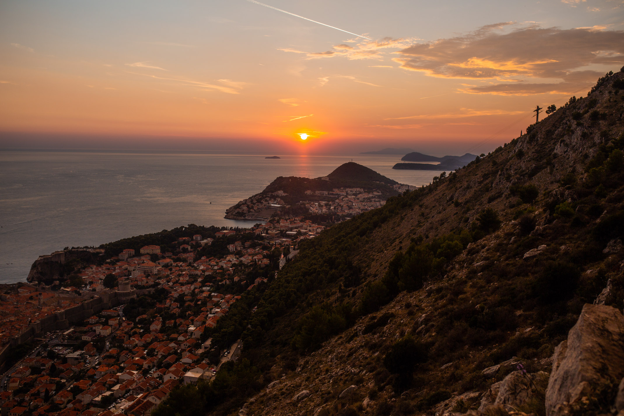


Iceland’s Ring Road circles the whole of the island throughout the North and South of Iceland and there are many sightseeing spots along the way. It can take up to an entire week to travel the Ring Road in good weather and up to 2 weeks in worse weather during the winter.
When I visited Iceland back in June I managed travelling Icelands southern ring road in 3 days (the majority of it) but split into different parts and did the furthest part last which includes Jokulsarlon and the DC-3 Plane Crash Wreckage and stopped over in Höfn for a night before making our way back to Reykjavik whilst stopping on route.
TRAVELLING ICELANDS SOUTHERN RING ROAD // TRAVEL GUIDE

STOP ONE: REYKJADALUR NATURAL HOT SPRINGS
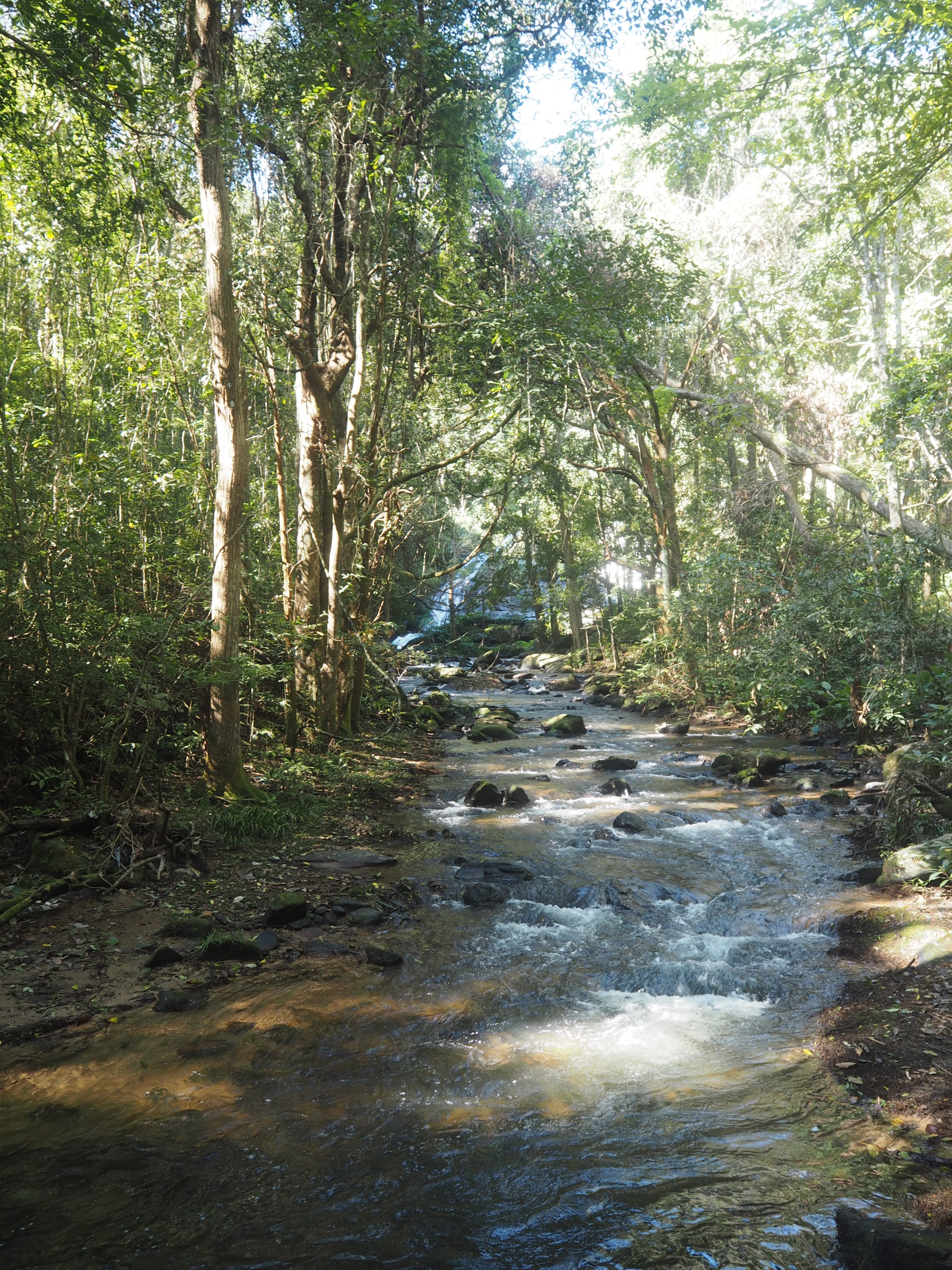
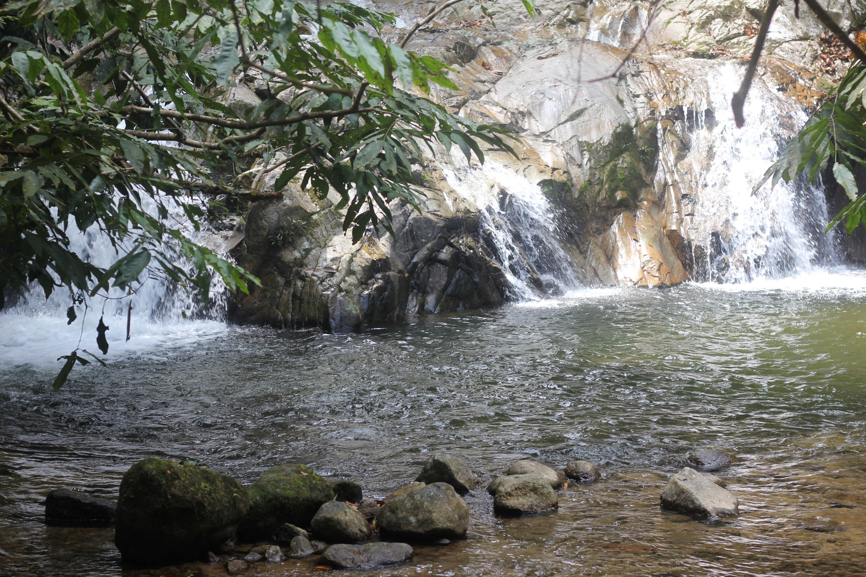
We started off our trip stopping off at the natural springs of Reykjadalur which is the perfect equivalent of the Blue Lagoon if you don’t fancy spending lots of money on an excursion. It took a little bit of a hike to actually get to the springs but it was totally worth it, walking past lots of sheep and wild horses and then some very smelly geysirs which stunk of sulfur (very bad rotten egg smell) so you have to hold your breath quite a bit.
Once we arrived at the springs it was a very long river which was a lovely warm temperature but there are a lot of flies about so beware of that but once you get past that it’s totally relaxing.

STOP TWO: GEYSIR
The Geysir was one of the main tourist stops on our journey along the Ring Road that we stopped at. We took a walk around the Geysir area to watch the different geysirs go off and caught some amazing footage. We then walked into the tourist shop for some food and to use the toilets. The main Geysir goes off every 6-10 minutes and you are warned to stand back unless you want to be drenched by hot water.
It was the first geyser described in a printed source and the first known to modern Europeans. Eruptions at Geysir can hurl boiling water up to 70 meters in the air. The Geysir has had it’s activity affected by earthquakes over the years. It is free to enter and visit the Geysir national park.

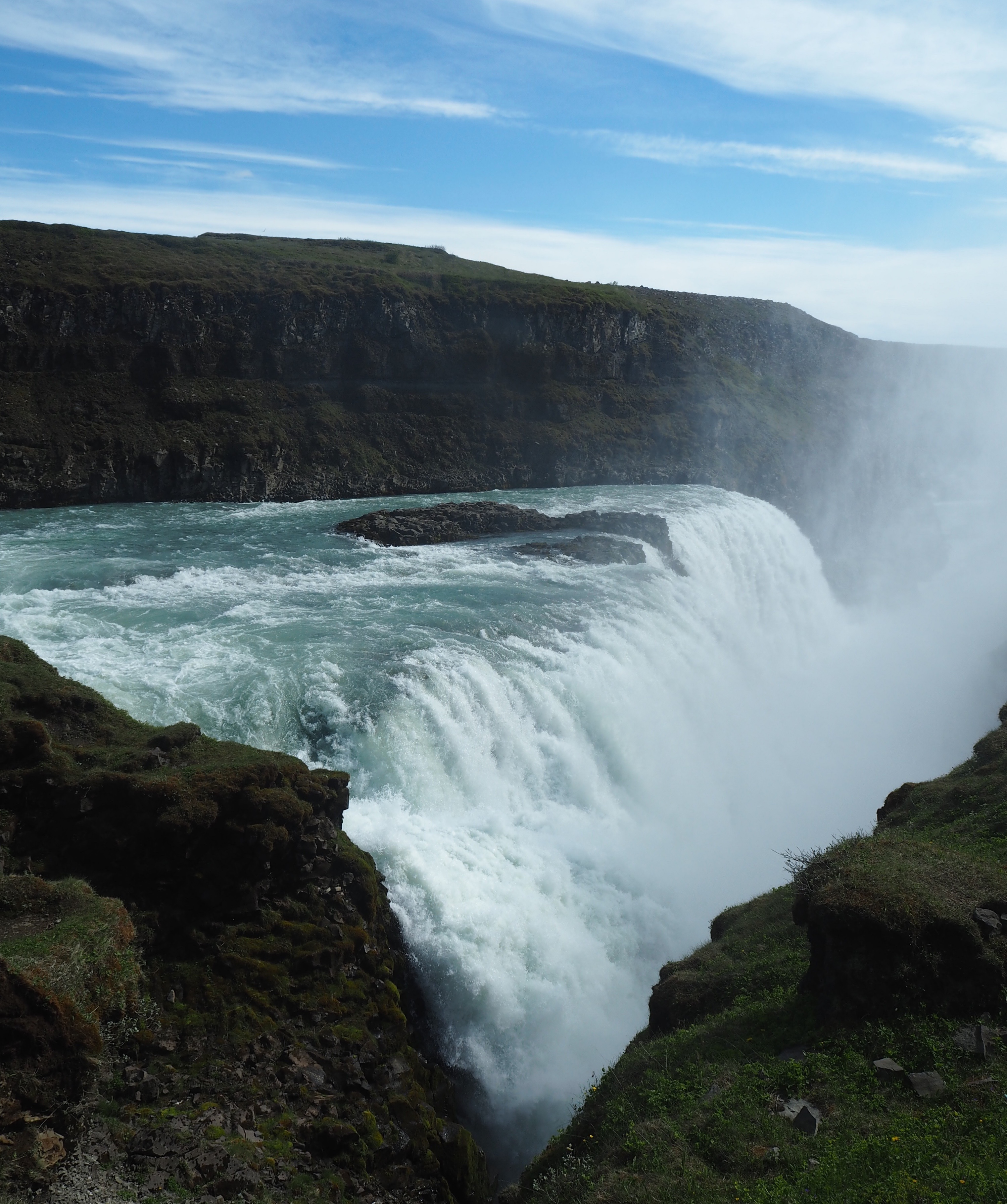
STOP THREE: GULLFOSS
The next big stop we made on our road trip which was on a beautiful sunny day and the spray from the waterfall was creating a beautiful bright rainbow spanning across the waterfall. Gullfoss is the closest waterfall to Reykjavik and is the 4th tallest waterfall reaching a height of 32m and is rumoured to be used for creating geothermal energy but that rumour has been shot down. There is a nice little path which takes you down towards the waterfall a little further so you can get a better look at it and also a perfect opportunity for pictures.
To travel around the Ring Road it’s best to hire a car or book a transport bus. To read about hiring a car, make sure you read my post here.

STOP FOUR: SELJALANDSFOSS
Seljalandsfoss is the 2nd tallest waterfall alongside Skogafoss, measuring again at 60m. This waterfall you can walk behind to get stunning views of the scenery with the water running in front of you. I warn you – you’ll need to wear waterproof clothing as you do get very wet when standing near the waterfall and also make sure you wear suitable footwear with grips as the floor surrounding can get very slippy and is very uneven. The water’s origin is from the volcano glacier Eyjafjallajökull which erupted back in 2010 that caused the massive ash cloud over Europe.
READ MORE: Travelling Iceland’s Southern Ring Road

STOP FIVE: SKOGAFOSS
Skogafoss is also the 2nd tallest waterfall reaching a height of 60m. According to legend, the first Viking settler in the area, Þrasi Þórólfsson. Buried a treasure in a cave behind the waterfall. The legend continues that locals found the chest years later, but were only able to grasp the ring on the side of the chest before it disappeared again.
The ring was allegedly given to the local church. The old church door ring is now in a museum, though whether it gives any credence to the folklore is debatable. At the eastern side of the waterfall, a hiking and trekking trail leads up to the pass Fimmvörðuháls between the glaciers Eyjafjallajökull and Mýrdalsjökull. This waterfall is based with a campsite around it in which you can stay in overnight. It’s quite a drive from Reykjavik so make sure you are prepared to stay overnight if you are going to drive to the furthest part south of the island.
NAVIGATE YOUR WAY AROUND THE RING ROAD…
Open this map on your phone whilst in Iceland to help you navigate your way to the different stops along the Ring Road. Press the star to save it to your Maps.

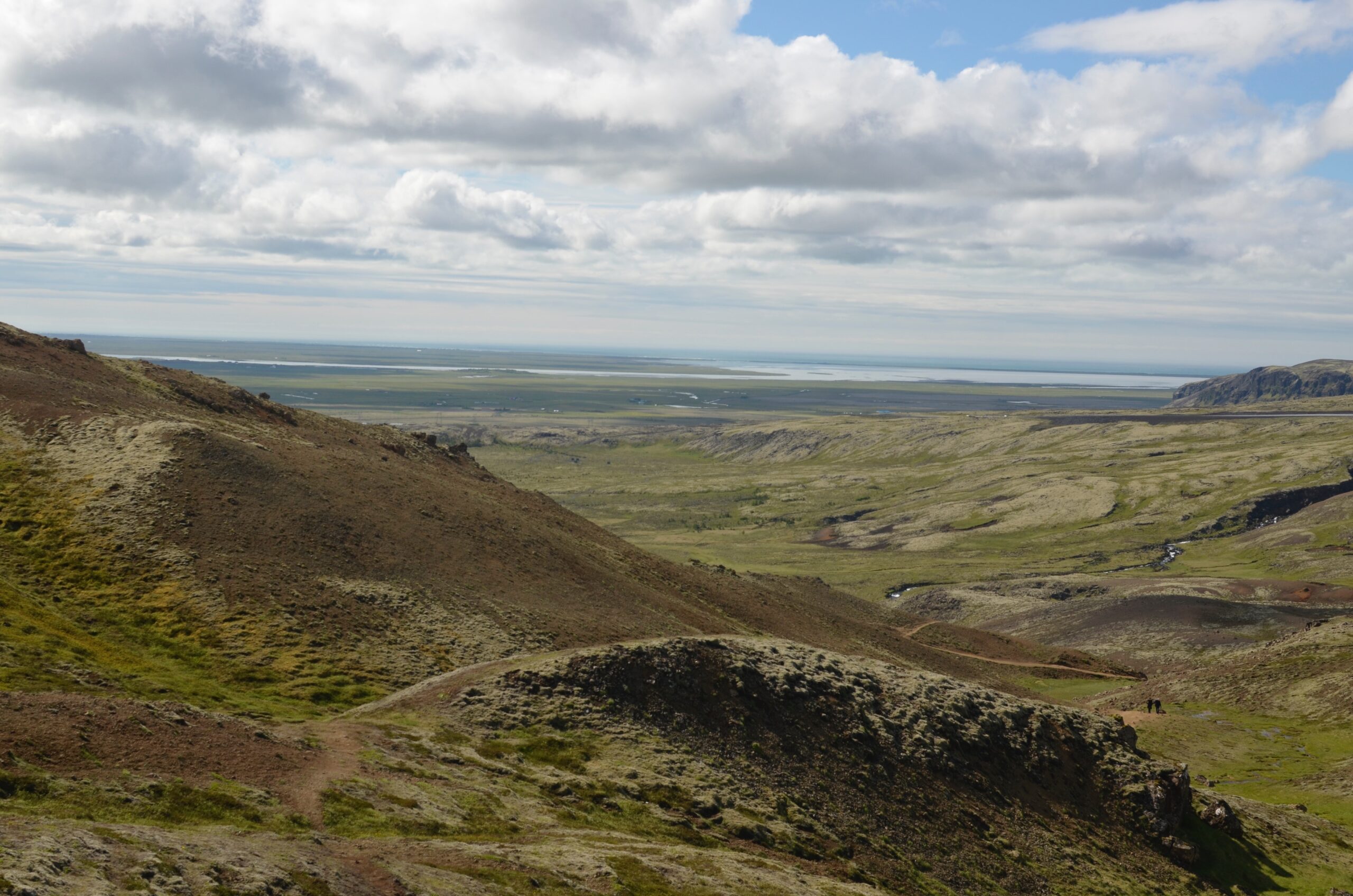
STOP SIX: MYDRALSJOKULL
This is probably one of the biggest glaciers in Iceland and its peak reaches the height of 1,493m. The icecap of the glacier covers an active volcano called Katla. The caldera of the volcano has a diameter of 10 km (6 mi). And the volcano erupts usually every 40–80 years. The last eruption took place in 1918. Scientists are actively monitoring the volcano, particularly after the eruption of nearby Eyjafjallajökull which erupted in April 2010. Since the year 1930, 16 eruptions have been documented. This glacier is receding by 500m a year due to global warming. You can even book an excursion to walk on the glacier with a specialist team who provide you with lots of safety gear.
READ MORE: 6 Places To Eat In Iceland

STOP SEVEN: SOLHEIMAJOKULL
Another glacial tongue which can be seen from the Ring Road, located in Vik. The glacier snout Solheimajokull is the southwestern outlet of the Myrdalsjokull icecap. It is about 8 km long and 1-2 km wide. River Jokulsa discharges it, and is sometimes called “The Stinking River”. Because of its emission of sulphuric acid from sub-glacial high temperature areas.
The glacier advanced about 900 metres during the last few centuries, but retreated greatly from 1930 to 1964. In the nineties it advanced and almost managed to cover the Jokulhaus hill. Lagoons developed in the side valleys and one of them often emptied quite suddenly. The floods lasted a few days and created danger for the passers by.

STOP EIGHT: REYNISDRANGAR
Commonly known as ‘The Black Beach’, this beach has completely black sand and stones. Stretching alongside basalt sea stacks and a cave. In 1991 it was ranked one of the most beautiful non-tropical beaches in the world.

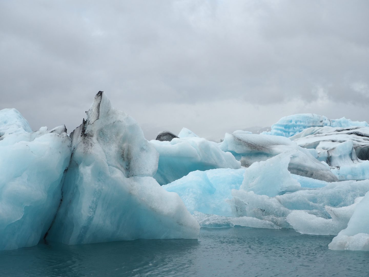
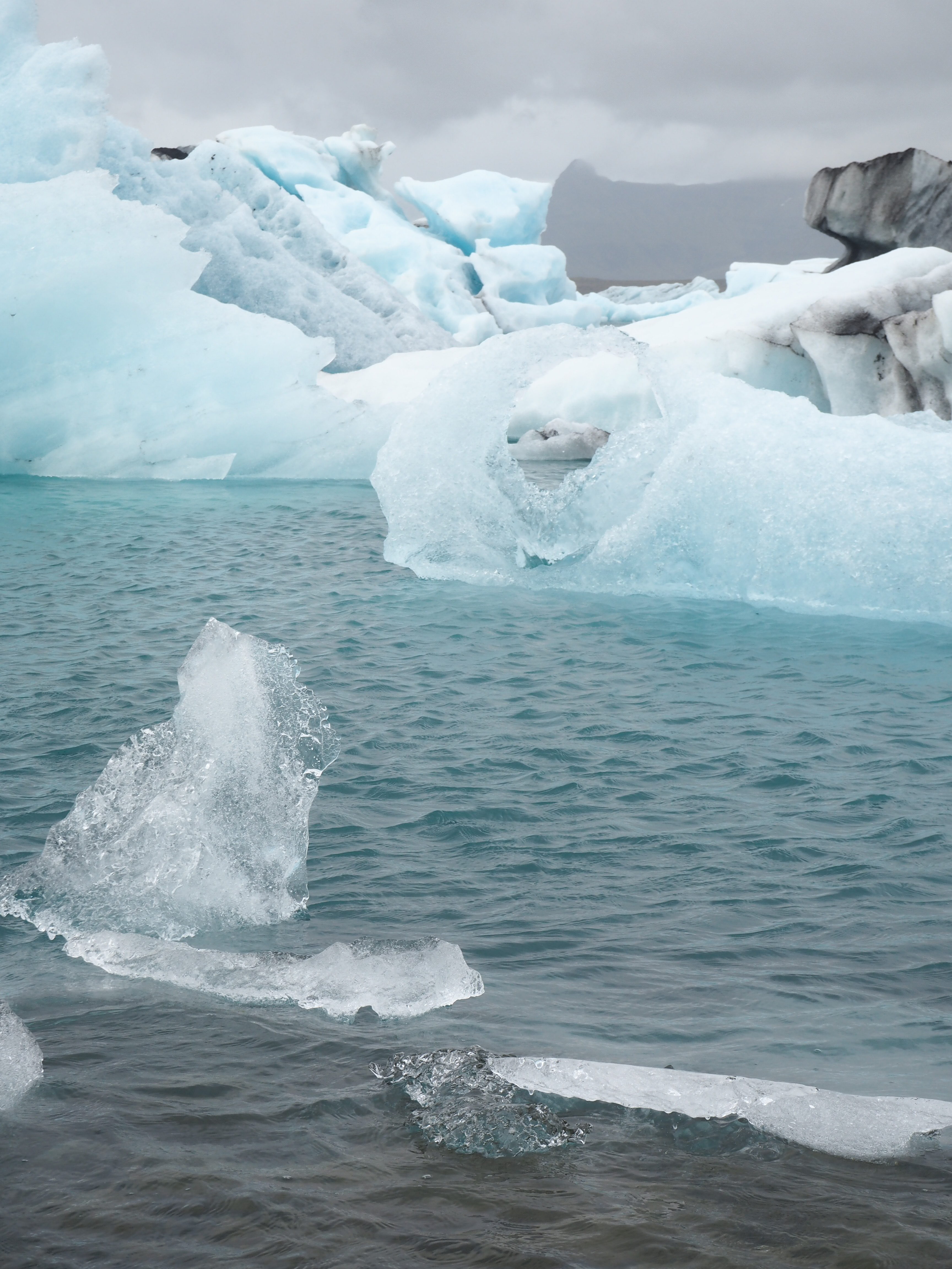
STOP NINE: JOKULSARLON GLACIER LAGOON
Probably my biggest highlight from the whole trip to Iceland as it felt so ‘out of this world’. It was so surreal standing in front of a whole lagoon filled with mini icebergs with gorgeous hues of white, black and blue. The black in icebergs come from the remaining ash from the volcano.

STOP TEN: SVINAFELLSJOKULL
One of the glacial tongues which is more further out to the south of the island. It has it’s own mini iceberg lagoon. It was quite windy when we visited. As a lot of photographers on a trip, had to tie their tri-pods down to stop them blowing away.

STOP ELEVEN: DC-3 PLANE CRASH WRECKAGE
The very last destination on our Ring Road trip, as it was the further out into the sound of the island. It’s quite a hike to get to but is worth it for very post-apocalyptic shots which feel very creepy! You can read more about the DC-3 Plane Crash Wreckage here and here. You are better off going at a non-busy time which is quite hard to predict. But it got so annoying when you kept getting people standing in the way of your shot. Make sure you spend a good amount of time there. As the hike is quite a long way, just for a few photos and you don’t want to miss anything.
Other Posts To Read & Enjoy…
★ The Glaciers To See In Iceland
★ Travel Diary | Iceland
★ Hiring A Car In Iceland & Things You Need To Know
★ Exploring Sólheimasandur’s DC-3 Plane Wreckage
★ Staying In The Stakkholt Reykjavik Apartments
PLEASE SHARE THIS POST AND GIVE IT SOME LOVE !!


What would you like to do most if you visit Iceland? Have you done any of these things? Let me know in the comments.


0 Comments